


Author's Route Journal
Rather than add a day-by-day account of the trip I want to just make a list of lessons learned/tips/bits of advice for anyone who takes a similar trip along this route or any part of it.
Del Rio: There are plenty of stores here. Camping at Lake Amistad is uncrowded and reasonably priced. The views are great too. US Highway 90 has a nice wide shoulder, but it is a trucking route and so has a good bit of traffic. Be careful crossing Lake Amistad as the bridge does not have a decent shoulder and traffic is fast moving.
Comstock: What stores/cafe may be open may change from time to time. Do not count on finding anything there. Also, if you don't have AT&T phone service you will not be able to make calls or send text messages in most parts of the Texas Hill Country.
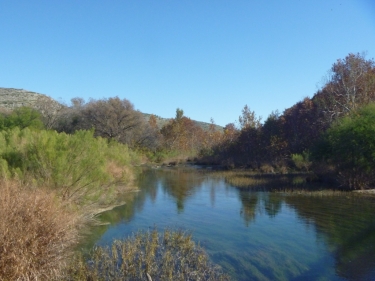
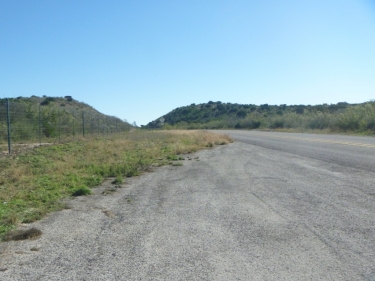
Hwy 163 north of Comstock is remote. The Devil's River crossing is very beautiful. There is almost no traffic. There are NO services. The 'town' of Juno appears on the map, but you are 50 years too late to get anything there. At the intersection of Hwy 163 and FM 189 there is a wall you can camp behind.
The Sutton County roads are remote and have little traffic. They are well maintained, though.
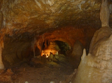
Caverns of Sonora is well worth the visit. They actually have more tours available than advertised. If you are a serious caver you can take a longer tour which includes some rope work. The campground is simple, but clean. The store sells homemade fudge. That alone was worth the ride out there.
Sonora is more than just a stop along the interstate. There is a good hardware store in town in case you need to make repairs like I did. Near the courthouse is a small museum, and up on the hill is a nature center with trails and exhibits. There are some good places to eat and cheap lodging.
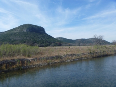
TX Hwy 55 takes you over the highest points of the Edwards Plateau. The ride is relatively flat all the way to Rocksprings.
Rocksprings has a fancy hotel as well as a very nice motel 'Sorrells Inn' There are places to eat, a small grocery store and a visitors center. There is a washeteria in the Valero gas station next to the grocery store (Lowes). Nearby is the Devils Sinkhole bat cave, but you have to drive a car to get to it. See the visitor's center for more info.
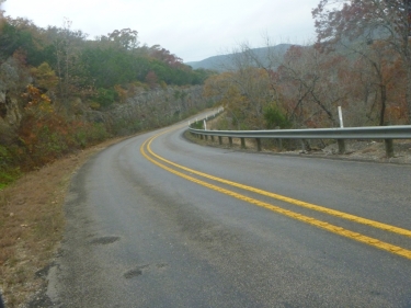
FM 335 is one of the 'Three Sisters'. It is an incredible twisty ride with amazing Hill Country scenery. It is also a very popular drive for motorcyclists as well as cars, so be careful!
Camp Wood has a few good places to eat as well as a swimming hole at the west end of 7th street. South of town is a campground and next door to that is a place that serves free coffee all day long.
FM 337 towards Vanderpool is another of the 'three sisters.' They air evac out one injured motorcyclist every week, so pay attention and listen up for approaching vehicles. The climbs are lung busting. If you don't die of a heart attack here on your tour you probably wont ever die of a heart attack.
Leakey (pronounced Lakey) has lots of places to eat. It's a bit touristy with lots of Harley riders during the good weather. They are almost always very friendly and are our friends out there.
Near the intersection of FM 337 and FM 187 there is store. It sells food and supplies. They will let you camp out back for $10/night. This is better than Lost Maples State park. That park is great, but is often full.
I took FM 337 through the non-existent town of Vanderpool to get to Medina and then on to Kerrville. In the past I rode the more northerly route through Hunt and Ingram. I would recommend going that way. FM 337 before Medina was busy, even on a Sunday morning and the drives were pretty hostile. The road was narrow and the climbs very steep, but scenic.
Medina has a few places to eat but is closed on Sunday.
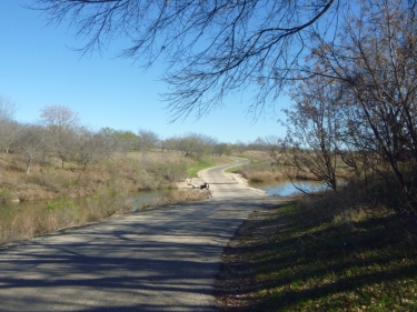
FM 689 Bandera Highway has nice wide shoulders and takes you all the way to Kerrville.
Kerrville has everything you could ask for. The park Kerrville Schreiner is a great place to camp. There is a 10' wide concrete mixed use trail that connects the park to downtown in case you are sick of fighting the traffic. The trail takes you to the local HEB (about 2.5 miles from park).
The ACA Southern Tier route has you take some other back roads north from Kerrville to Fredericksburg. I have been on some of them on other trips and wasn't that impressed. I took HWY 16 instead. It is a busy road, but it does have wide shoulders. There is one hill north of Kerrville, but then it is easy going the rest of the way.
Kott Road: Take the back roads that parallel Hwy 16 whenever possible. They are scenic and have no traffic.
Fredericksburg: There are museums, stores, lots of Bed and Breakfasts. I camp at the Lady Bird campground south of town. It is not the most beautiful spot, but it is cheap and most of town is touristy and expensive.
Hope this helps. If you have questions, please contact me!
If you want to participate in the conversation you must login first.
redfalcon
redfalcon
redfalcon
redfalcon